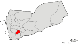
Ash Shu'ayb District
Ash Shu'ayb District
مديرية الشعيب Alshaib | |
|---|---|
 | |
 | |
| Country | |
| Governorate | Dhale |
| Area | |
• Total | 338 km2 (131 sq mi) |
| Elevation | 2,084 m (6,837 ft) |
| Population (2003) | |
• Total | 38,261 |
| Time zone | UTC+3 (Yemen Standard Time) |
Ash Shu'ayb District is a district of the Dhale Governorate, Yemen. As of 2003, the district had a population of 38,261 inhabitants.[2]
Location
[edit]Ash Shu'ayb district (Shuaib) is located between longitude (44.833) eastward, and latitude (13.83) northward. Al Shu'ayb is located on a plateau ranging from 3000 to 3,500 feet in the north-west of Aden. It is about 140 miles away, and the Shuaib (North) and North (West) The eastern side, the Dhale Governorate and the [Halimin Directorate] from the southern side. Among the most important villages: Al-Awabel (the capital of the Directorate[3]), Al Madu, Hathara, Houf, Lasbour, Qazaah, Bakhael, Maklan, Rabat, Kahreeh, Jabbab, Ja'afer, Lnajud, lwdeeha, Gabel Kadapa, Raghb.
Al Shuaib Directorate enjoys a cool climate for its rise above sea level.
Notable mountains in the district include Hay'd Urshi, Jabal Harir and Jabal Khudr.[3]
References
[edit]- ^ ID Geonames ash shu,ayb 6940881
- ^ "Districts of Yemen". Statoids. Archived from the original on 29 November 2010. Retrieved October 17, 2010.
- ^ a b "Yemen: Al Dhale'e Governate" (PDF). Humanitarian Response. United Nations Office for the Coordination of Humanitarian Affairs. March 30, 2014. Archived (PDF) from the original on 2021-04-22. Retrieved April 23, 2021.
